
Campus life
Campus map
Twenty-six numbered stops on 86 acres. Everything is a ten-minute walk from everything else.
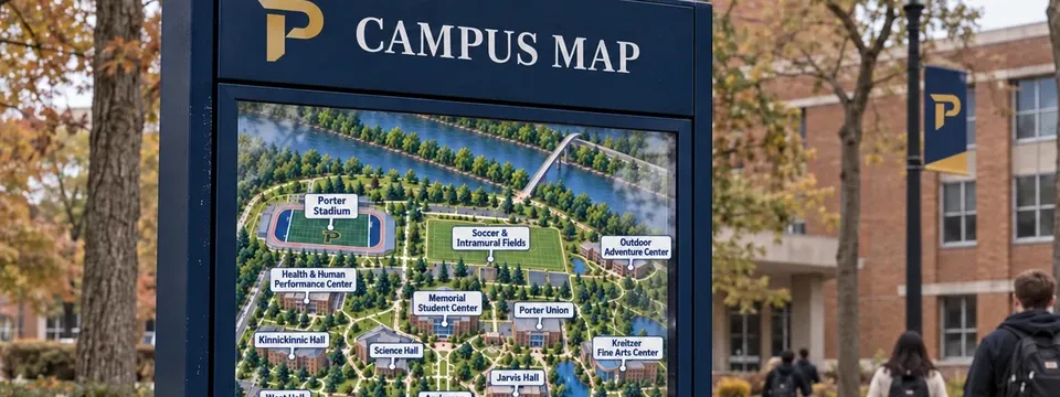
Browse the building directory → — what is inside each building and how to get in.
Campus runs from the Welcome Center at the main entrance on University Drive, around a central quad anchored by Andersen Library, out to residence halls on the west side, athletics and recreation fields along the Red Cedar River to the north, and support services and the University Farm to the east; a few academic buildings further toward downtown Porter Falls — Founders Hall and Commerce Hall among them — sit just outside the main quad area. For a step-free, elevator-and-entrance schematic instead, see the accessible campus map.
Academic core
Science Hall, Jarvis Hall (home to the Jarvis Technology Center), Andersen Library — still signed by its early-2000s name; nearly everyone on campus calls it Halvorsen Library after the 2014 wing that doubled its size — the Applied Arts Center, and the Health & Human Performance Center ring the quad, with Memorial Student Center and Porter Union just east of it.
Residential
Kinnickinnic, West, East, and Red Cedar residence halls and the University Apartments sit along the west edge, a short walk from the quad and from Bowman, Churchill, and Cleveland halls' classrooms.
Athletics & recreation
Porter Stadium — everyone still calls it "the Ironclad," map notwithstanding — the soccer and intramural fields, and the Outdoor Adventure Center line the riverfront to the north, with the Stout-Bound Trail continuing east to the Red Cedar State Trail.
Take the next step.
Applications for fall are open. No fee, no essay, and a decision in about two weeks.